Archived News

Many articles about the Eastern Trail are organized on this news archives page. The most recent articles appear immediately below, with the first part of each article displayed. Click on any article title, or the “Read More..” link to read the full text of that article.


Archived News

Eastern Trail expands into South Portland

By Michael Kelley, Staff Writer. May 30, 2014, The Scarborough Leader.

Officials from the Eastern Trail Management District have long dreamed of a time when a bicyclist, runner or walker could continuously travel off-road from the Piscataqua River in Kittery to Casco Bay in South Portland. Now, thanks to funding from the Portland Area Comprehensive Transportation System (PACTS), that dream is a little bit closer to happening.

The communities of Scarborough and South Portland recently received $350,000 from PACTS to extend the Eastern Trail from Pleasant Hill Road in Scarborough to Wainwright Field in South Portland. The .8 mile trail, once completed, will go from Wainwright Field through the woods past Prouts Pond along Central Maine Power property before connecting to Pleasant Hill Road.

“We have advertised this as a trail between Kittery and Casco Bay and with this, now we are getting closer and closer to making that a reality,” said Eastern Trail Management District President Tad Redway.

The Eastern Trail passes through a dozen communities in York and Cumberland counties and is part of the East Coast Greenway, a 2,900-mile corridor that spans Maine to Florida.

Scarborough Town Planner Dan Bacon said the total cost of the project is $531,000. The remainder of the funding comes from money South Portland had already set aside for trail expansion.

“There was already money waiting to be used, but not enough for the entire .8 miles,” Bacon said.

Bacon said the plan is to finalize designs and get permitting approval this summer and fall and start construction in late fall or early winter. The money, Bacon said, was not supposed to be available for another year or two, but given the fact money had already been appropriated and PACTS had some money left over in its fiscal budget, the organization decided to use some of that money to fund the project.

The trail expansion project, Bacon said, coincides with a two-year project by the Maine Department of Transportation and the Scarborough Department of Public Works to reconstruct Pleasant Hill Road and make it more pedestrian friendly.

Read the entire article online here

Share this article:

Archived News

Funding will help complete Eastern Trail between Scarborough, South Portland

By Shelby Carignan, Staff Writer. Friday, May 30, 2014. The Forecaster.

SCARBOROUGH — Officials confirmed that the town has received enough funding to begin closing the gap in the Eastern Trail between South Portland and Scarborough.

Though the $376,000 from the Portland Area Comprehensive Transportation System will not complete the 1.5-mile section from the Nonesuch River in Scarborough to Wainwright Athletic Complex in South Portland, it green-lights construction on a smaller segment just under a mile long from Wainwright to Pleasant Hill Road. 

Construction will likely begin late this year or early in 2015.

Nearly a third of the pedestrian and bike trail, which extends 65 miles from Bug Light Park in South Portland to Kittery, is completely off-road, according to Robert Hamblen, president of the Eastern Trail Alliance. The ultimate goal is to connect the entire trail via pedestrian pathways. 

The segment from Arundel to South Portland is 85 percent off-road, with the two most prominent interruptions remaining between Saco and Biddeford, and Scarborough and South Portland. The Maine Department of Transportation has studied plans to close those gaps, and determined that both require bridges.

“Both of them are expensive, but we firmly believe both will happen,” Hamblen said. “They’ve just both been laying there waiting for funding to make it possible.”

Read the entire article online here.

Share this article:


Archived News

Deirdre Fleming: Eastern Trail on the road to further expansion

Nearly 20 years of expansion has proven successful, and more is on the way.

Sunday, May 25, 12:01 A.M.

Pennsylvania trail guru Carl Knoch said it takes decades to build an off-road, long-distance bike path through urban areas.

In southern Maine it’s been nearly 17 years since the Eastern Trail was launched. And as we close in on two decades of work, the effort behind this urban trail has gained ground, quite literally.

I can attest to that, having spent the past decade waiting for the Eastern Trail Alliance, the nonprofit behind the trail’s development, to make it worth my while as a long-distance cyclist.

Four years ago the Eastern Trail Alliance founder, John Andrews, promised me they’d get me an off-road commuter route from my home in Kennebunkport to Portland. True to his word, it happened a year later when the Eastern Trail bicycle-and-pedestrian bridges were built over Route 1 and Interstate 95, and five miles of trails were added between Kennebunk and Old Orchard Beach.

Andrews and his band of bicyclists have proven relentless. And this summer they’re not slowing as they fan out across this trail that now covers 20.7 miles to conduct an economic-impact study to help build support to expand the trail to Wells, South Berwick, Eliot and Kittery.

An Eastern Trail sign along Broadturn Road in Scarborough is part of a well-signed route for cyclists. Not bad for an idea formed less than two decades ago.
In 2001, when I arrived at the Maine Sunday Telegram, all that existed of the trail was a 5-mile section in South Portland. But there was talk of expanding it as far as Kittery. And all I could think was, how likely is that?

On the other hand, you had to agree it was a good idea. So Staff Photographer Greg Rec and I saddled up our road bikes with reporting and photography equipment, and set out to cover the 70-plus miles of the proposed trail that had just been marked along the roads that followed the proposed off-road route.

We started at dawn from the Route 1 bridge over the Piscataqua River in Kittery and rode to dusk, taking photographs along the way and finishing at Bug Light in South Portland, where an editor ferried us back to our cars. Then as we each drove north from the Piscataqua River as the sun set, I worried we’d both fall asleep at the wheel. But I also recalled the sight of old barns, rocky brooks, wildflower fields and birch tree groves. Suddenly I saw this crazy idea anew.

Read the Entire Article Online Here.

Share this article:

Archived News

Eastern Trail 10th Anniversary

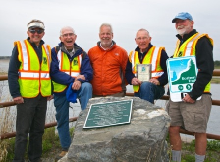
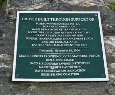
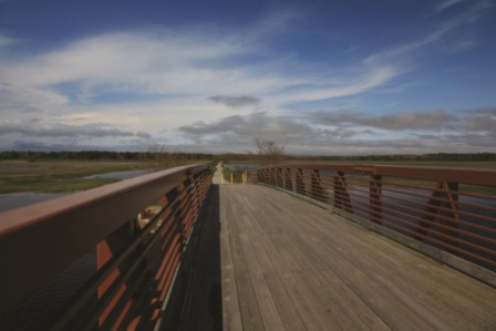
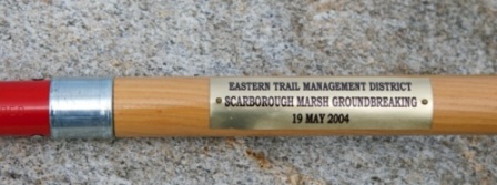
Eastern Trail 10th Anniversary at Scarborough MarshMonday May 19, 2014 marks ten years since ground was broken for construction of the Scarborough Marsh section of the Eastern Trail. The project was managed under the direction of the 12-town Eastern Trail Management District in partnership with many organizations including the Town of Scarborough. That section has generated amazing public support for the Eastern Trail.

Could anyone with their groundbreaking shovels in hand have imagined what would be accomplished in the following ten years?

Congratulations and many thanks to the hundreds, and thousands who believed in and supported the Eastern Trail vision and have worked so hard to continue building the first 21 miles of our off-road trail. Since that historic day, we have truly demonstrated that “if you build it, they will come.”

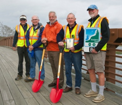
Several Eastern Trail leaders, and visionaries, who led the efforts to get this project designed, funded, and off the ground, gathered on the Scarborough Marsh bridge on May 19 to mark the 10th anniversary (all photos by Jim Bucar):


scar marsh anniv 3

scar marsh anniv

scar marsh anniv 4

marsh ET bridge shot

Share this Article:

Archived News

Old Orchard Beach on path for trail expansion

Posted: Wednesday, April 30, 2014 3:56 pm | By Kayla J. Collins kayla@keepmecurrent.com |

OLD ORCHARD BEACH – The next phase of developing 72 acres near the intersection of Portland Avenue and Milliken Mills Road in Old Orchard Beach as a multi-use forestry space and public recreational area is under way.
The Town Council has accepted a $2,802 bid from stewardship forester Parker Forestry Associates, North Berwick, to inventory the property and create a Forest Management Plan that would include a description of land ownership objectives and what can be done to improve the site.

In January, the town received a matching grant for about $8,000 from Project Canopy and the Maine State Forest Service to help extend the network of recreational trails in the community, and to preserve 68 acres of land off Portland Avenue as wildlife habitat, according to Conservation Commission member Kimbark Smith, who is also the project manager for what has been dubbed the Milliken Mill Woods project.

Design and construction of the trails, which includes painting a crosswalk to connect the properties and erecting kiosks, will depend upon the help of volunteers and in-kind donations, Smith said.

Along with the Conservation Commission, other partners in the Milliken Mill Woods project include the Eastern Trail Alliance, Saco Bay Trails, the Ocean Park Conservation Society, the Pathway Alternative Education Program of Old Orchard Beach High School and the Bicycling Coalition of Maine.

This is the second major project the Conservation Commission has undertaken to expand Old Orchard Beach’s trail system, said Mark Koenigs, project manager for the Easter Trail Connector Sub Committee.

Read the entire article online here.

Archived News

Wells Seeks Funding for Design of Trail

[Note: This article appeared in the Spring 2014 Newsletter. The full newsletter can be viewed in this pdf document]

By Marianne Goodine, Treasurer, ETMD

Ready for the Trail in WellsAs we spring ahead and look forward to warmer weather, the Town of Wells is working together with the Town of Kennebunk to continue the trail southward through Wells to the North Berwick Town Line. Wells is currently putting the finishing touches on its Fiscal 2015 budget and will present to the Wells voters at the Annual Town Meeting on June 10 a funding article to “Undertake with the Town of Kennebunk preliminary design of the Eastern Trail through Wells and Kennebunk along the Granite State Gas Pipeline Transmission corridor.”

This request for $30,000 will enable Wells to join the Town of Kennebunk in this first stage— completing an engineering design— of ultimately constructing 7 miles of trail through Wells.  To reduce the cost to citizens of Wells, most of the work will be done in-house by the Town Engineer/Planner.  If you are a Wells resident I ask that you come to the polls on June 10 and vote in favor of this article to continue the trail southward through Wells and reap the benefits of this unique asset.

Share this Story:

Archived News

Joe Yuhas

[Note: This article appeared in the Spring 2014 Newsletter. The full newsletter can be viewed in this pdf document]

By Brenda Edmands

Joe YuhasThe ET provides a space for recreation, transportation and socialization for all users. And sometimes it provides a lift when your life has hit some rough patches.

When Joe Yuhas’ wife Delpha was going through some intense stages of her illness, she and others urged Joe, her primary caregiver, to take a break each day. Her doctor’s office was on Route 1, near Scarborough Marsh. So, as Joe explains, “I would throw my bike in my truck, go to the doctor’s to pick up her prescriptions, then ride the trail for an hour or so,”

The exercise, the beauty of nature and the change always helped him find a path back to at least a small sense of balance. Shortly after his wife’s death, the dedication of the KAB section of the ET close to his home only reinforced the positive feelings he had about the trail.

It has seemed only natural, then, over the past three and half years for Joe to volunteer more and more frequently for the ETA.

He had already been volunteering for “small tasks here and there” for some time after meeting John Andrews in the parking lot of Saco’s Dyer Library. As Joe puts it, “Next thing I knew I was stuffing envelopes.” (This is a frequent experience of those who meet JA.) He’s still helping with mailings, but he’s now also serving as a trustee and trail ambassador, and as a Sag wagon driver for the Maine Lighthouse Ride. He also staffs information booths at such events as school health and wellness fairs, attends community meetings, and gives talks to groups about the trail. Whew!

A former head of the life sciences department at St. Francis in Biddeford (later UNE) and biology teacher at Kennebunk High School, where he started their oceanography program, Joe is really in his element when sharing his knowledge about the natural life along the trail. This is readily apparent when he is leading one of the ETA’s increasingly popular full-moon walks/snowshoes/skis. He says the walks “take me back to my graduate school days when I worked as a naturalist for the Columbus, OH, Metropolitan Parks.” He also enjoys how the walks are making him brush up some dusty corners of knowledge about birds and plants.

He doesn’t know if it’s because of his experiences with the ET or not, but recently he began teaching indoors again, too, leading a course in Natural History at York County Senior College.

His favorite natural encounters so far on the ET are baby snapping turtles crossing in front of him and the one beaver he spotted near the site of last year’s trail flooding. “It was around 40 pounds,” he said. While he acknowledges it probably helped to build the dam that caused the trail damage, from his description you can’t help feeling that he might be rooting, just slightly, for the beaver.

Joe enjoys the people he gets to meet as well.This winter he led a moonlight walk with a large group on snowshoes, including many Boy Scouts and their troop leaders.He’s also been impressed by users he’s encountered in warmer times, like the woman from Nova Scotia who was riding the East Coast Greenway (which ET is a part of) all the way from Halifax to Cape Cod, her bike fully loaded with gear. He also finds it somehow reassuring to see his own cardiologist regularly riding the trail.

He wouldn’t say he “necessarily looks forward to having to rescue people” as a Sag wagon driver during the annual MLR, but he admits, “I do find it gratifying” to assist those in need. And though he worries that it sounds “cheesy,” he says what he really likes best about helping at the ride is  “cheering the riders in as they come across the finish line.”

Have we mentioned how very, very lucky wefeel to have Joe volunteering for us?

Share this Story:

Archived News

What’s the Economic Impact of the Eastern Trail?

[Note: This article appeared in the Spring 2014 Newsletter. The full newsletter can be viewed in this pdf document]

by John Andrews

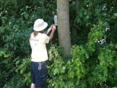
Trail Counter Mounted on a TreeWho uses the ET? Where do users come from? What does the average visitor spend on ice cream? Boots? Bicycles? Lodging? Beyond a little casual knowledge— I’ve met cyclists on the ET who came from Vermont, New York and Quebec just to bike the ET— we have no measured data. We intuit that these users must benefit local economies, but we haven’t yet quantified those benefits. How can we measure them? What have others done?

Carl Knoch, Northeast Trails Development Manager for the Rails to Trails Conservancy (RTC), wanted to answer these questions for a Pennsylvania trail. He electronically counted users and asked hundreds of Pennsylvania trail users to answer self-mailing questionnaires. With the results, he began to measure the trail’s economic impact, learning how many people

used the these trails, where they came from, and what they spent RTC has subsequently applied Carl’s methodology to dozens of trails and published the results, all the while evolving a better, more refined methodology.

This season, thanks to a generous grant from Kennebunk Savings Bank, ETA will be applying Carl’s methods to measure the economic impact on the local communities of the off-road sections of the ET from Kennebunk to Scarborough. The process has already begun: Canadian-made infrared electronic counters are being tested; and self-mailing surveys are being printed. ETA plans to publish its economic impact study at the end of 2014. And you can meet Carl Knoch, who will be the feature speaker at ETA’s annual meeting on May 15.
(See a related article here.)

Share this Story:

Archived News

10th Anniversary Scarborough Marsh Groundbreaking

[Note: This article appeared in the Spring 2014 Newsletter. The full newsletter can be viewed in this pdf document]

By John Andrews

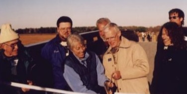
Scarborouch Marsh Bridge Ribbon CuttingDo any of you remember the old waste water pipe bridge over the Dunstan River that meanders through the marsh? I’m sure you remember its replacement, the Eastern Trail Bridge that carries trail traffic while supporting both that pipe and the Granite State Gas Pipeline. I doesn’t seem possible, but ten years have already passed since the May 19, 2004 groundbreaking ceremony took place a few weeks after the accompanying photo was taken.

Bikers on BridgeWe’ve made unbelievable progress since 2004, enough to prove the “Lenny Ruthazer Principle,” named after a wise engineering manager from my past life. Lenny asserted that “You will always overestimate what you can accomplish in a year and very much under estimate what you can accomplish in ten.”
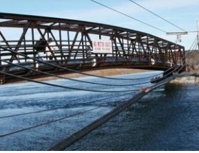
Lenny, I wish you could know how right you were! As we of the ETA consider the future of the Eastern Trail, we will do well to keep hearing his words.

Old Bridge

Share this Story:

Archived News

Leave it to the Beavers

[Note: This article appeared in the Spring 2014 Newsletter. The full newsletter can be viewed in this pdf document]

By Joe Yuhas

Beaver WorkPrior to and on October 13, 2013 (a Friday!) heavy rains covered over half a mile of the Biddeford section of the Eastern Trail with impassable flood waters. Reluctantly, we closed the trail, an unprecedented action. The ET website and ET Facebook page immediately relayed to trail users that we had informed Unitil and Biddeford’s department of public works and city manager that the section of the trail would be closed until further notice.

As a further complication, an event had been scheduled on that section of the trail for the following day. As you might imagine there was concern about how long the trail would be closed. But even more perplexing, was the question of how and why the flooding occurred. The trail had been open for over three years and had not flooded after many periods of prolonged heavy rains. What had changed?

The answer was Castor canadensi, i.e.,beaver, that industrious engineering rodent, the only other mammal besides humans that commonly alters its habitat to make it more suitable. Looking back, earlier in the summer many users of the Biddeford section of the Eastern Trail had noticed beaver activity in the vicinity of the 23¼ mile marker. That area, not far from the Arundel line, is marked by a culvert which passes beneath the trail with a broad open area along the trail. The wetland area there attracts many waterfowl and wading birds; with close observation, minnows can be seen feeding beneath the surface of the water. And a beaver family had evidently taken up residence.

I remember noticing the increasing number of branches and small trees being added to the edges of the impounded water on the opposite side of the trail early in the summer. Although I had not seen the beavers working, it became clear that they were busily constructing a dam. As the summer progressed, I noticed how the water level was rising and the noise of rushing water became more pronounced over the weeks as the height of the beaver dam rose. All very picturesque and appealing, but….

It is not unusual to see the results of the beavers’ work without seeing the beavers themselves, since they generally avoid humans and are nocturnal in their habits. Clearly, as the work progressed the water level on the upstream side of the trail inched its way upward. Apparently the beavers had also blocked the culvert, compounding the problem. By the first week of September the water level had risen nearly four feet and spread over an extended number of acres. The heavy rains did the rest: the force of all the impounded water washed out a large section of the trail.

Fortunately, the story does have a happy ending. First of all the scheduled event — the NF Walk — was relocated to the Thornton Academy section of the trail with little problem. Then Biddeford public works and Unitil responded immediately; in five days, including work over the weekend, the trail was again passable. The two agencies hauled in rock and rebuilt the trail over an extended length. The beaver dam was breached and the culvert cleared. And what about the busy beavers?

The whole family was gently trapped and relocated to a friendlier home.

Share this Story:

https://www.easterntrail.org/